What are GPR & EM, what are their advantages, disadvantages, and why use both?
Ground Penetrating Radar (GPR) and Electromagnetic Locating (EM) are the two most widely used technologies by GeoScan.
We will address the advantages and disadvantages of both and why it is always best practice to use both sets of equipment, where possible, to determine the depth and location of utilities.

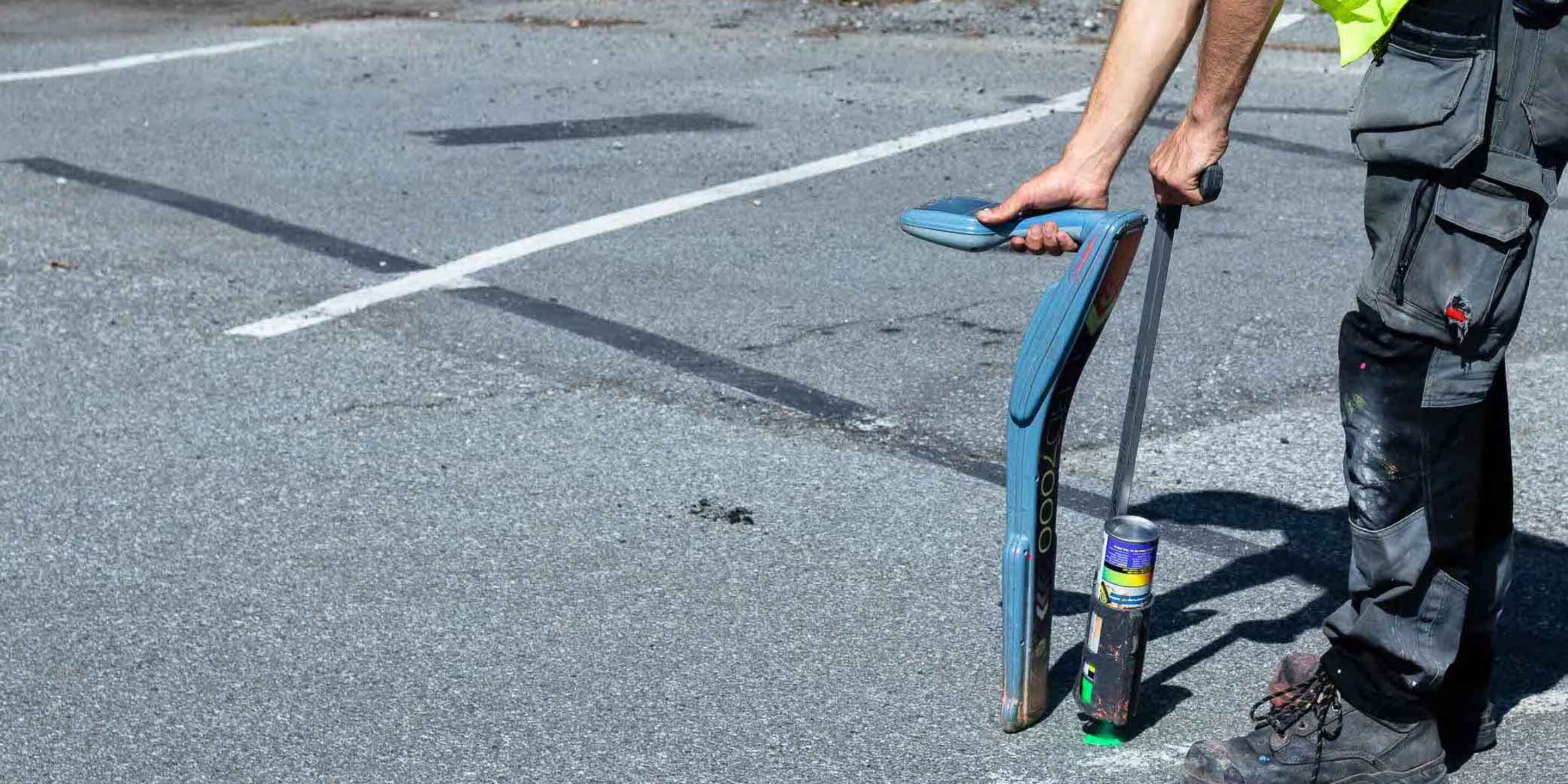
Collecting GPR transects in Northern BC. Data acquired was then post processed in order to assess the conditions of the subsurface.
What is GPR?
Ground Penetrating Radar works by emitting a signal from a radar antenna (transmitted signal) which enters the subsurface and reflects off objects with differing dielectric values than the surrounding medium. These reflections make their way back to the receiver unit of the antenna (received signal) and a two-way travel time can be used to calculate the depth and position of a given utility or unknown feature.
What are GPR’s advantages & disadvantages?
Advantages
- Detects most types of utilities including non-metallic pipes
- Real-time data collection
- Can also define subsurface characteristics unrelated to utilities such as depth to water table, voids, salt contamination, structural features (rebar or mesh) etc.
- Gathers detailed information on the subsurface which can then be georeferenced
- Useful to look for unknown or abandoned underground facilities
- 2D/3D models can be derived from collected data
Disadvantages
- Requires more intensive training than EM locating
- GPR data collection takes time – thus can be more costly than EM locating
- Unable to determine the nature of a utility from a radargram splice
- Terrain needs to be relatively flat to ensure optimal radar penetration
- Obstructions can reduce GPR scan extents
- Does not work well in areas saturated with water such as clay-based soils
- Post processing of GPR data can be time intensive
- Data interpretation is technician dependent – human error is a factor
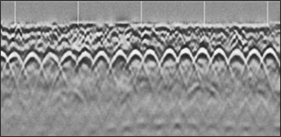
Real time GPR data from a bridge deck scan depicting the structural contents within the concrete.
What is EM Locating?
Electromagnetic locating is a tool which can be used either in active or passive modes. Active EM locating involves inducing an electromagnetic signal on to a desired conductive utility. Passive EM locating works by reading a frequency that occurs naturally such as high voltage electrical cables which emit a frequency of 60Hz in North America.

A GeoScan technician inserting a duct rod into a non-metallic storm drain pipe as a means to trace the pipe via EM locating.
What are EM Locating’s advantages & disadvantages?
Advantages
- EM locating can detect much smaller cables
- Active (direct connection, ring clamp, conductive, induction methods) and passive methods of EM locating
- It can identify sewers or other non-metallic pipes provided there is an access point
- Operates much quicker than GPR
- Has the ability to track a signal from the source of the transmitter
Disadvantages
- Can only trace conductive objects
- Tracing sewers via duct rod and EM locating can be time intensive
- Does not provide anywhere near as much subsurface information as GPR
- If pipe material changes or there is a break in the line the signal can be lost
- Signals can bleed on to nearby utilities especially in areas of utility congestion – can lead to utility misidentification
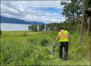
EM sweeps being conducted across terrain not suited for GPR scanning. GPR scanning has a lot more restrictions than EM locating.
Why do we use both GPR & EM?
Both instruments may be better at locating a specific target type – for example GPR is good at locating conductive and non-conductive whereas EM locating is limited to tracing metallic services.
Site conditions cannot always be determined prior to starting a project. Adverse weather conditions may limit the use of equipment – saturated soils or flooded regions greatly limit the effectiveness of a GPR scan. Having the ability to change equipment based on site conditions is of a huge benefit to the field technician.
By using two separate NDT scanning procedures the field technician can cross-reference data collected from both. If there are any discrepancies between the information then the technician can further investigate in order to provide the most accurate interpretation. The more underground information collected on a site the better as it leaves little to no room for surprise encounters when performing ground disturbance operations.
If you’d like to learn more about Subsurface Utility Engineering have a look at this great water line upgrade project. To speak to one of our experts about one of your upcoming project please enquire here. We’re also doing line locating in Fort St. John, so please get in touch if you’re in that region.