Create Accurate As-Built Drawings of Underground Infrastructure
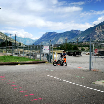
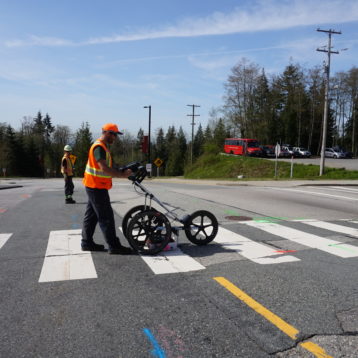
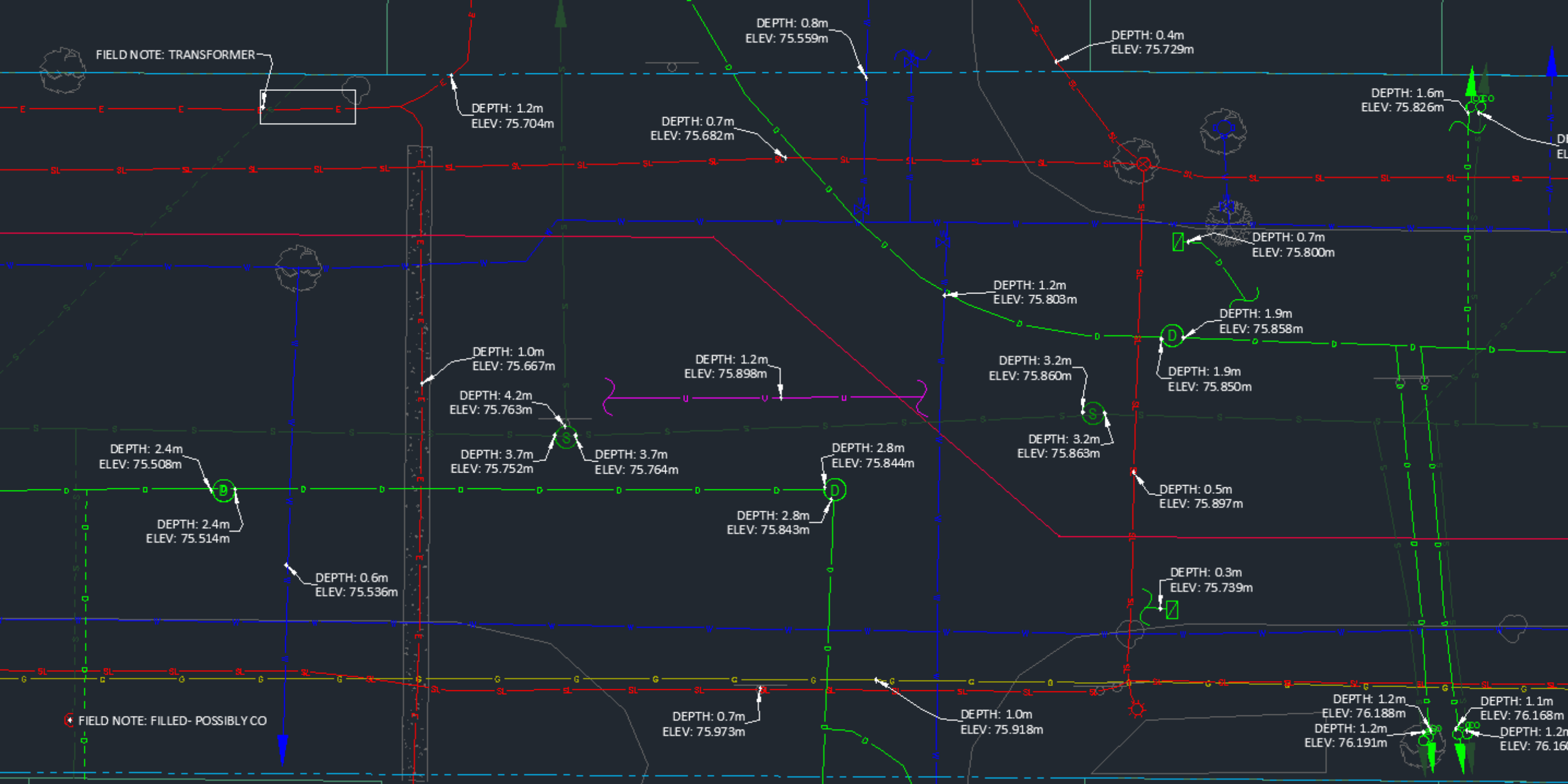
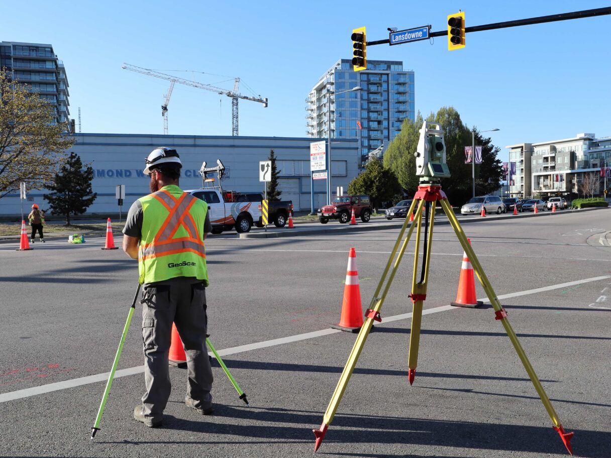
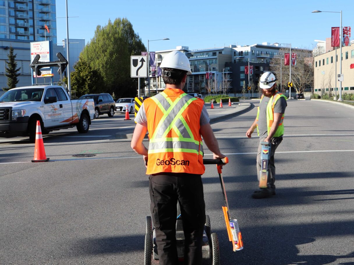
Subsurface Utility Engineering (SUE) involves trained professionals who use state of the art equipment and technology including ground penetrating radar (GPR) and electromagnetic equipment, to locate and map the existing underground infrastructure. Information gathered on the subsurface utilities located (utility nature, depth, location, orientation, material and dimensions) during the field survey are recorded and accurately georeferenced using survey grade GPS and total station.
Whether the work involves trenching, excavating, or drilling, implementing SUE is key to ensure the successful outcome of a project in relation to the management of risks associated with the underground utility infrastructure. The locate work performed by our technicians is governed by the ASCE 38-22 standards that provides a benchmark to show the integrity and quality of utility data collected.
If you’d like to understand more about the importance of SUE in the wider industry, read our article: The Importance of SUE.
Advantages
Subsurface Utility Engineering cuts project risk and therefore it also saves money. The Ontario Sewer and Watermain Contractors Association recently commissioned the University of Toronto to investigate the practice of using SUE on large infrastructure projects. The study determined that the average return rate for each dollar spent on SUE services was $3.41. Full paper can be found here.
The advantages of Subsurface Utility Engineering are HUGE in the construction industry. Having this valuable information on demand is critical for the pre-design phase of any project involving ground disturbance. Not only does it aid in project safety by avoiding risk resulting from damaged underground utilities, it also mitigates costs associated with utility repair, unanticipated development redesign, project delays, and various other unforeseen conflicts.
To help with building SUE RFPs/tenders and selecting the right package for you the ASCE has created a guide: “Subsurface Utility Engineering for Municipalities: Prequalification Criteria and Scope of Work Guide“.
To get your own copy contact us.
7-10% of all utility lines located were originally unknown, with no record of them existing
This incredible stat helps to understand the importance of risk mitigation in this industry. Up to 10% of utility lines not only have inaccurate locations, but are completely undetected in historical documentation.
The Process
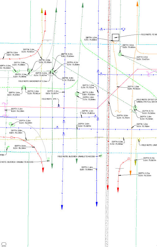
A SUE project is classified by four quality levels with the objective to improve the reliability of the data presented.
The highest quality level (quality level A) involves day lighting the utility once located to visually confirm the details of the structure as well as to allow for the most accurate horizontal and vertical positional measurements to be collected.
The majority of projects can reduce day lighting costs by using quality level B data. This uses data from geophysical methods to find and map utility data. This level of accuracy is predominantly required where conflicts arise with the proposed development alignment. Locate results are then surveyed and drafted to produce a scaled drawing showing the horizontal and vertical location of the underground infrastructure along with additional details and characteristics of the utilities.
Lower levels of SUE (quality levels C and D) are more suited for areas surrounding the projected design where underground infrastructure does not interfere with the ground disturbance. The finished product of SUE project contains all levels of data.
All Subsurface Utility Engineering projects are reviewed and approved/stamped by our in-house professional engineer.
Speak to our Team
Registered Utility Locating Technicians (RULT)
As leaders in the utility locating industry, GeoScan has tirelessly pushed for increased regulation and higher training standards. This culminated in the creation of the Registered Utility Locator Technician (RULT) certification available through ASTTBC.
This program produces competent and qualified technicians who provide the ground disturbance community and public with the confidence needed to complete projects competently and safely.
GeoScan’s Commitment
Every locate project we work on is stamped by a Registered Utility Locating Technician.
- They have met the ASTTBC competency and enrolment standards
- They are committed to a mandatory continuous professional development policy
- They are held to a high standard of ethics and professionalism in practice
- They are subject to periodic peer reviews and audits