Site characterization through electrical properties of the ground itself. Electrical Resistivity Tomography (ERT) is a versatile method in the geophysics toolbox.
It is suitable for a broad range of applications and environments such as groundwater prospecting and contamination, mineral exploration, geological mapping and geotechnical investigations.
Any variation in lithology, water saturation, fluid conductivity, porosity and permeability, impact the ability of an electrical current to flow through the ground. Measuring electrical resistivity acts as a proxy to provide insight, based on these variations, into the nature of stratigraphic units, geological structure, sinkholes, fractures and groundwater.
Our ERT system can be configured to provide individual 2D profiles or 3D coverage of a given survey area. By stacking individual data sets or ‘rolling along’ (extending a 2D line) the areas and depths that can be analysed is theoretically never ending.
Arranged as a dipole array, ERT can be used to measure vertical resistance in one given location to incredible depths. This technique is widely used in mineral exploration and for geological studies.
A similar related method which can be carried out alongside ERT is Induced Polarization (IP). This method uses the same array of electrodes as ERT measurements and collects data in a similar way, but yielding the chargability or electrical capacitance of ground materials. This method is most commonly applied in mineral exploration settings.
If you’d like to learn more, then read our project article: Conductivity using EM & ER Tomography
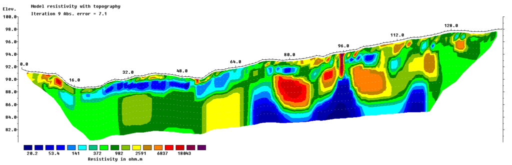
A typical ERT survey includes a topography survey along the line in order to put the findings into context. The above example shows a lot of variations in the subsurface within a short distance. It shows bedrock under quaternary sediments, glacial boulders and saturated soil within the survey area. The interpretation is a complex procedure that involves the processed data set and the analysis of every available additional information.
How it Works
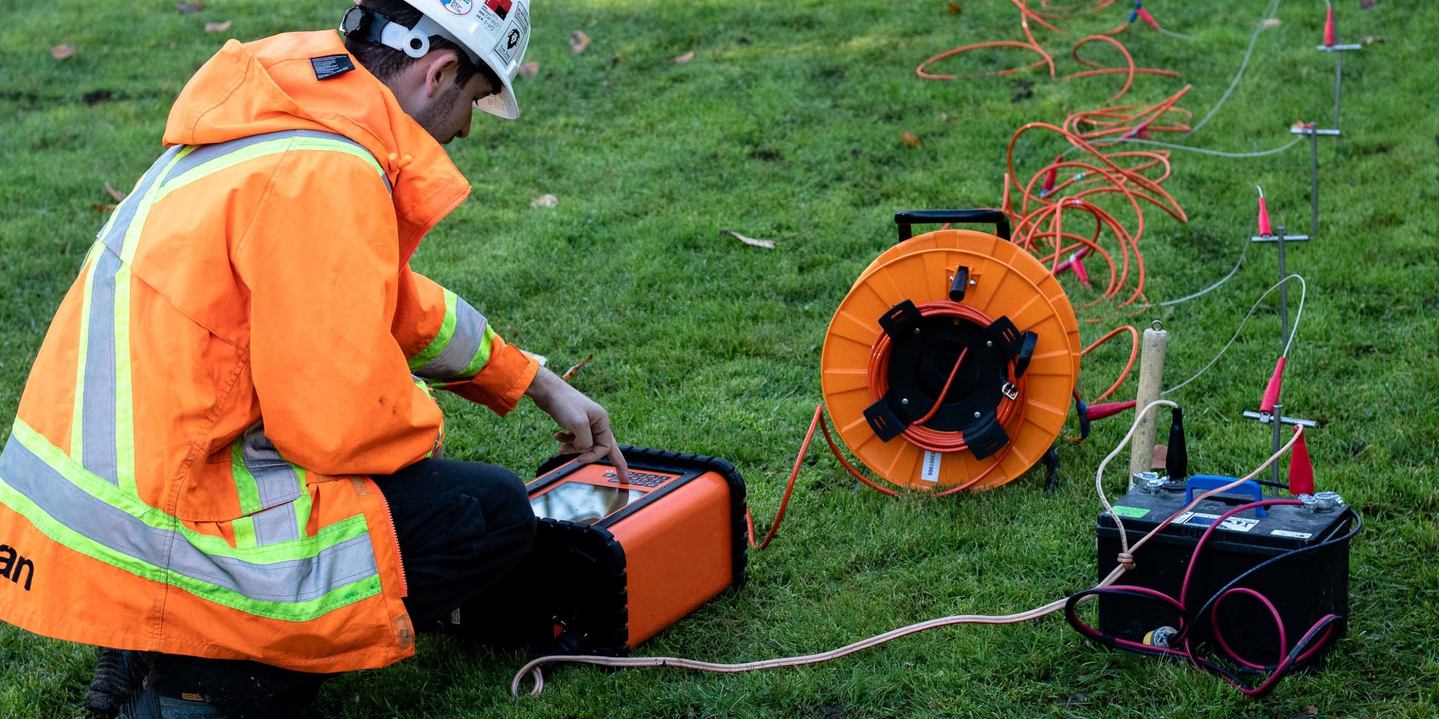
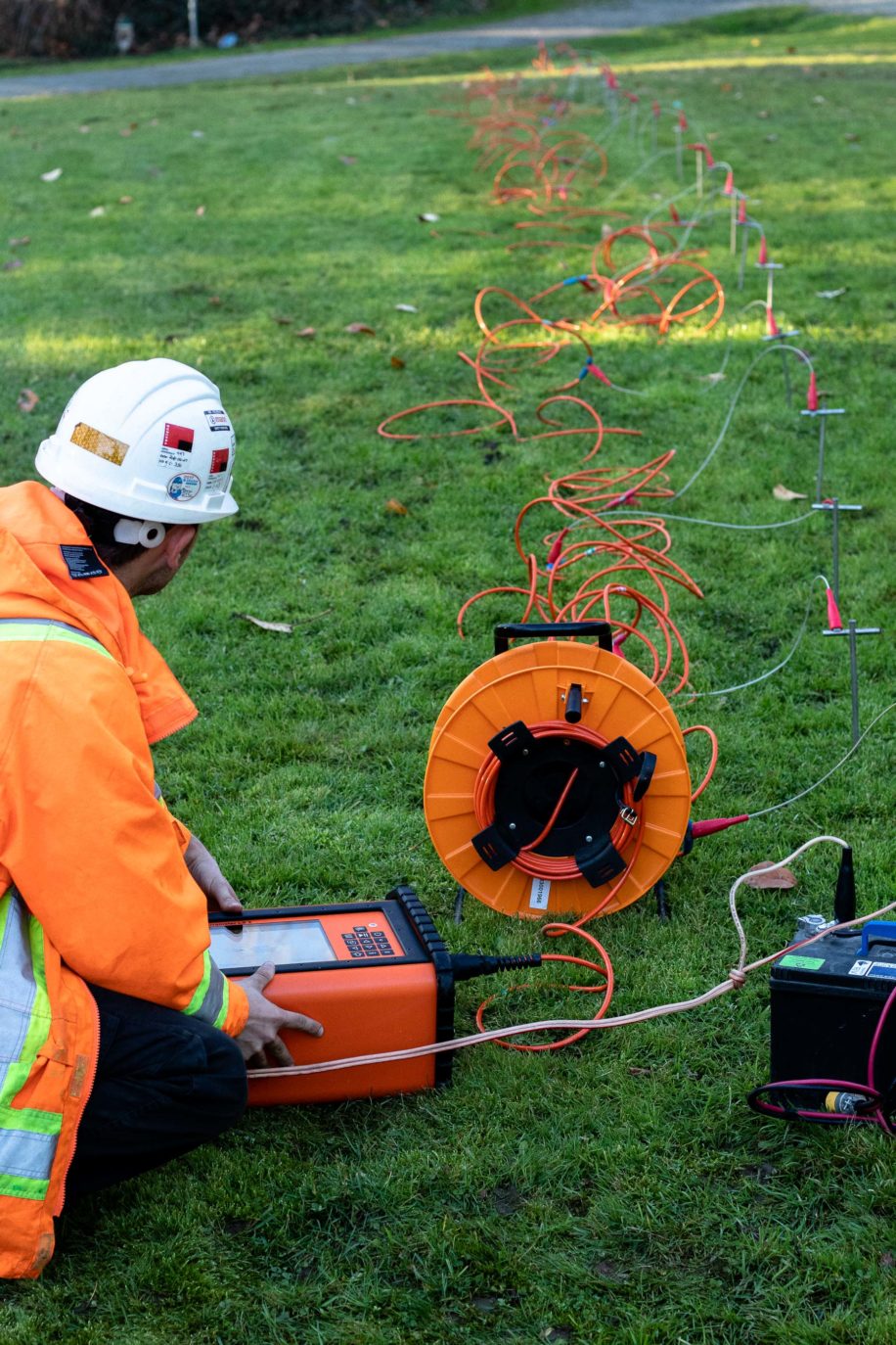
The acquisition of ERT data involves the injection of current into the ground via an array of electrodes. Measurements of resistivity are then recorded via combinations of current and potential electrode pairs, building a profile cross-section and/or 3D model of apparent resistivity within the survey area. The depth of investigation depends on the electrode separation and geometry, with greater electrode separations yielding bulk resistivity measurements from greater depths.
To learn more please have a look through our blog pages or get in touch.