GeoScan is expanding its range of services by introducing cutting-edge Mobile Mapping and LiDAR Services.
With state-of-the-art technology from Rock Robotic, GeoScan can capture accurate and detailed 3D LiDAR and Photogrammetry data for their projects. This new addition to our repertoire reinforces our commitment to delivering innovative solutions and staying at the forefront of the geospatial industry.
What are LiDAR Surveys?
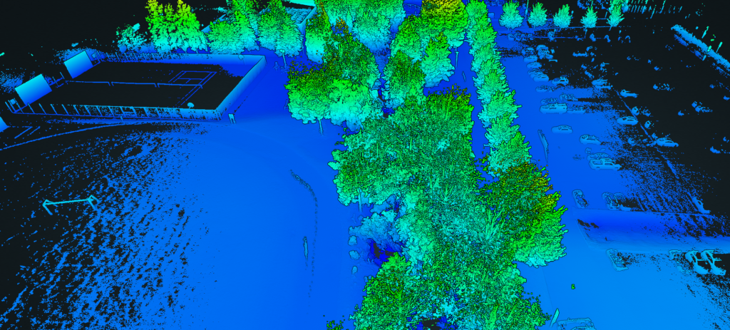
LiDAR surveys – also known as laser scanning surveys – are a type of remote sensing technology that uses lasers to measure distances and create highly detailed 3D models of landscapes and structures. LiDAR stands for “Light Detection and Ranging.”
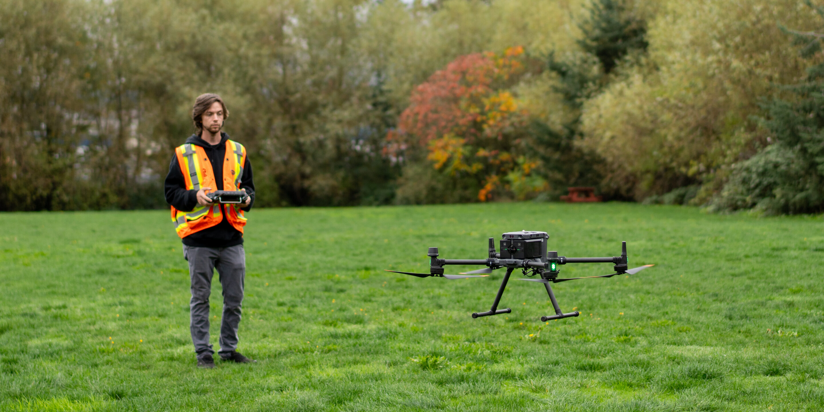
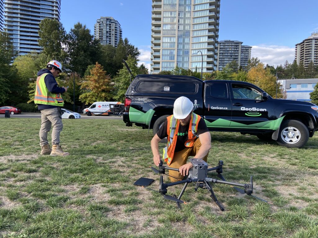
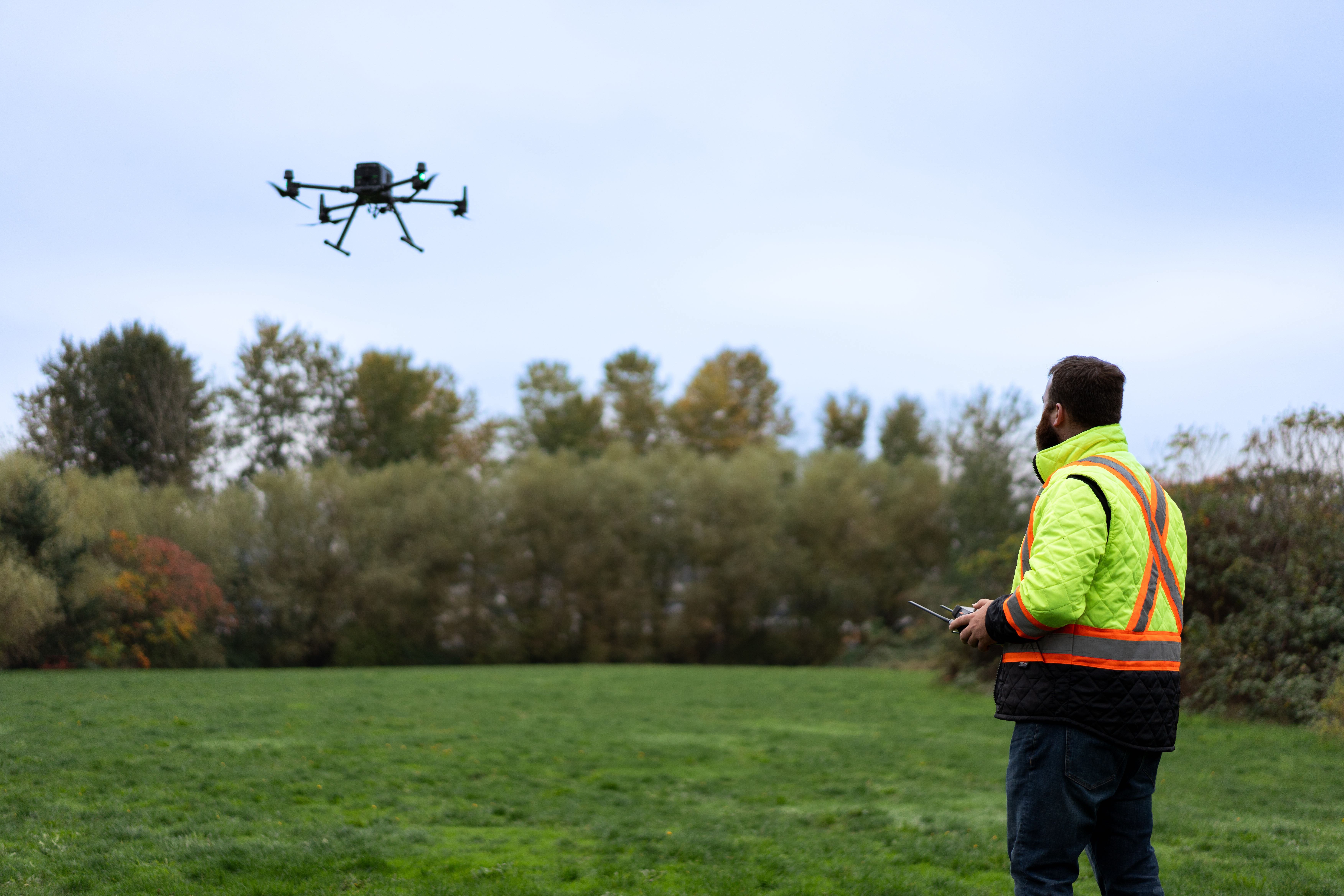
We use the Rock Robotic R3 Laser Scanner. It’s an exceptional piece of equipment that combines accuracy, versatility, and ease of use in one robust package. This device utilizes laser technology to capture highly precise point cloud data. It enables our team of professionals to generate detailed 3D models and maps with remarkable efficiency. Furthermore, it can be mounted to a UAV or a vehicle or carried by a surveyor in tight areas such as a tunnel or a densely forested area.
Key Features and Benefits:
Unmatched Accuracy: Our LiDAR surveys offer an impressive accuracy range of up to a few millimeters. This level of precision ensures that even the finest details of the scanned environment are captured, allowing us to provide our clients with reliable and highly accurate data for their projects.
Versatility for Diverse Applications: Whether it’s land surveying, construction site documentation, infrastructure inspection, or environmental monitoring, LiDAR surveys prove to be a versatile tool. Their adaptability to various industries and applications makes them a valuable asset for those requiring efficient data acquisition.
Rapid Data Acquisition: With the ability to scan up to 200,000 points per second, LiDAR surveys significantly speed up the data acquisition process. This translates into reduced project timelines, increased productivity, and ultimately, cost savings for our clients.
Enhanced Safety and Accessibility: The remote operation capability of LiDAR surveys ensures the safety of professionals while working in hazardous or challenging environments. It allows our team to collect data in areas that are difficult to access, such as rugged terrains, tall structures, or restricted spaces.
Streamlined Workflow: The integration of LiDAR surveys with advanced software solutions streamlines the entire workflow. Our team can process, analyze, and visualize the captured data seamlessly, facilitating efficient decision-making and project management.
Work With GeoScan For Unparalleled LiDAR Services:
By partnering with GeoScan, clients gain access to a team of experienced geospatial professionals who possess a deep understanding of LiDAR technology and its applications. GeoScan is dedicated to assisting clients throughout the data acquisition process, from planning and scanning to data processing and analysis. We strive to deliver tailored solutions that meet the unique requirements of each project, ensuring high-quality results and customer satisfaction.
The introduction of LiDAR to GeoScan’s service offerings marks an exciting development for our company and our clients. This cutting-edge technology brings unprecedented accuracy, versatility, and efficiency to various sectors. With GeoScan’s expertise and commitment to excellence, clients can now leverage the power of LiDAR to unlock a world of possibilities for their projects. Contact us today to discover how this revolutionary technology can transform your operations.