September 2019
GeoScan were called to conduct a utility locate survey by a client installing a storm water force main in order to transport fluids through a 400m trench.
Engineers had designed a route for the 400m pipe without taking into consideration the possibility of utilities crossing the proposed trench line. GeoScan were contacted to assess the site and determine whether the route of the pipe encountered any existing or old utilities, in addition to any potential subsurface obstructions that may interfere with the work.
Location
BC
Industry
Oil & Gas
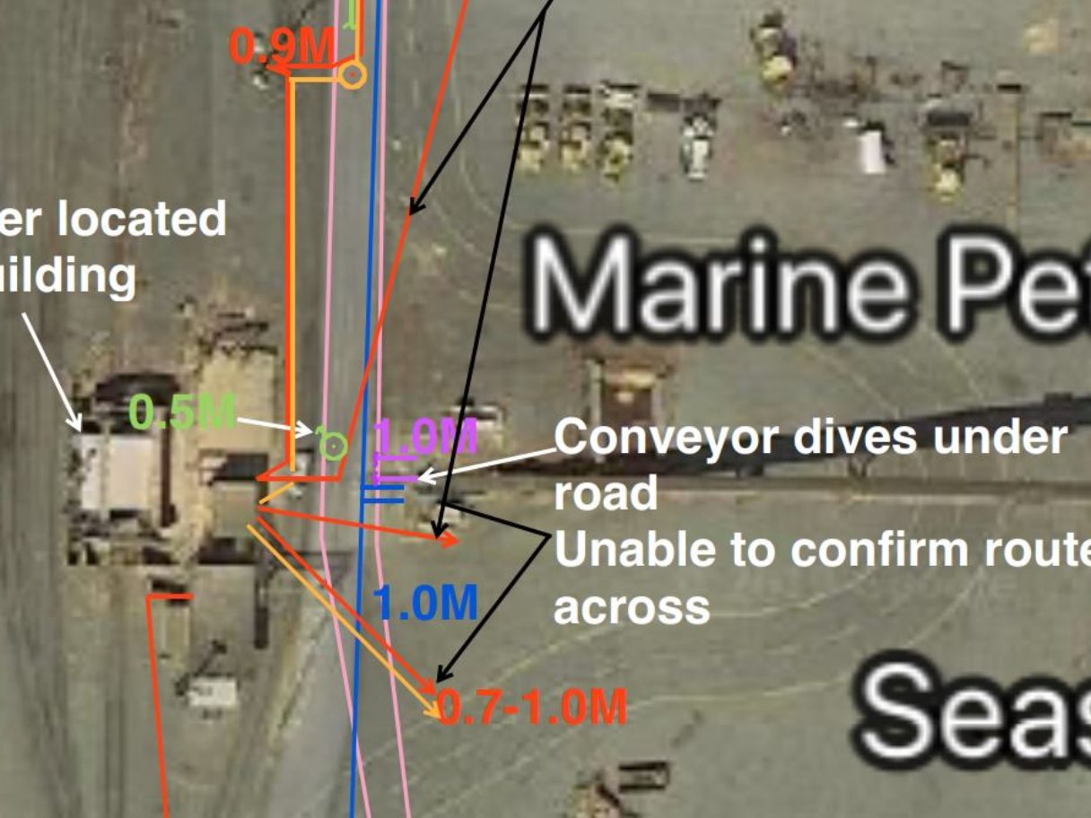
Situation
BC One Call and GIS were unable to provide much information for the utilities on the site, so we were challenged with conducting the survey based on utility surface features, such as manholes, power drops, valves and hydrants in addition to performing utility locate scans on the trench line.
Solution
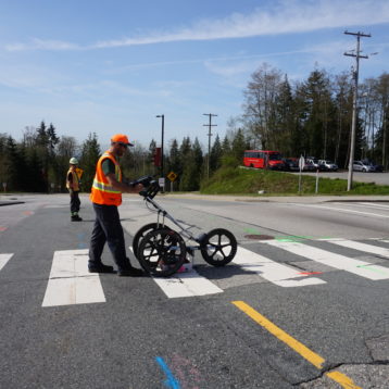
Our GeoScan technicians utilized Ground Penetrating Radar (GPR) and Electromagnetic Locating to analyze the site and determine if there were any anomalies crossing the trench that would interfere with the proposed pipeline.
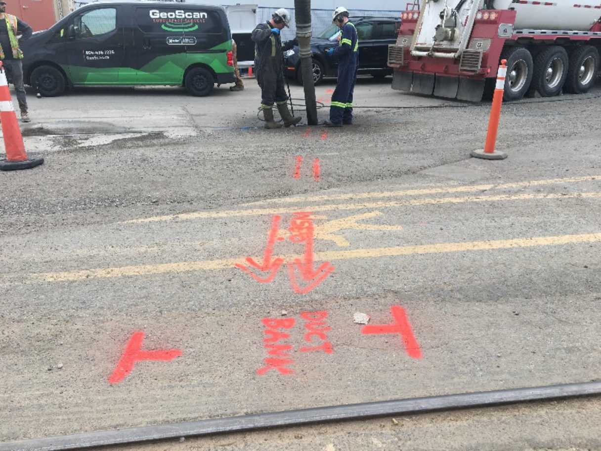
After conducting the GPR and EM surveys we also carried out a site walkthrough where we found an additional electrical duct bank where the cables had been cut, meaning that the EM was unable to detect them. Carrying out an additional scan we discovered more conduits crossing the trench.
As a result of the utility locate the pipeline trajectory is now being re-evaluated by the engineers in charge of the project. Had the client not booked the locate they would have hit multiple utilities causing significant disruption and costs to their project.