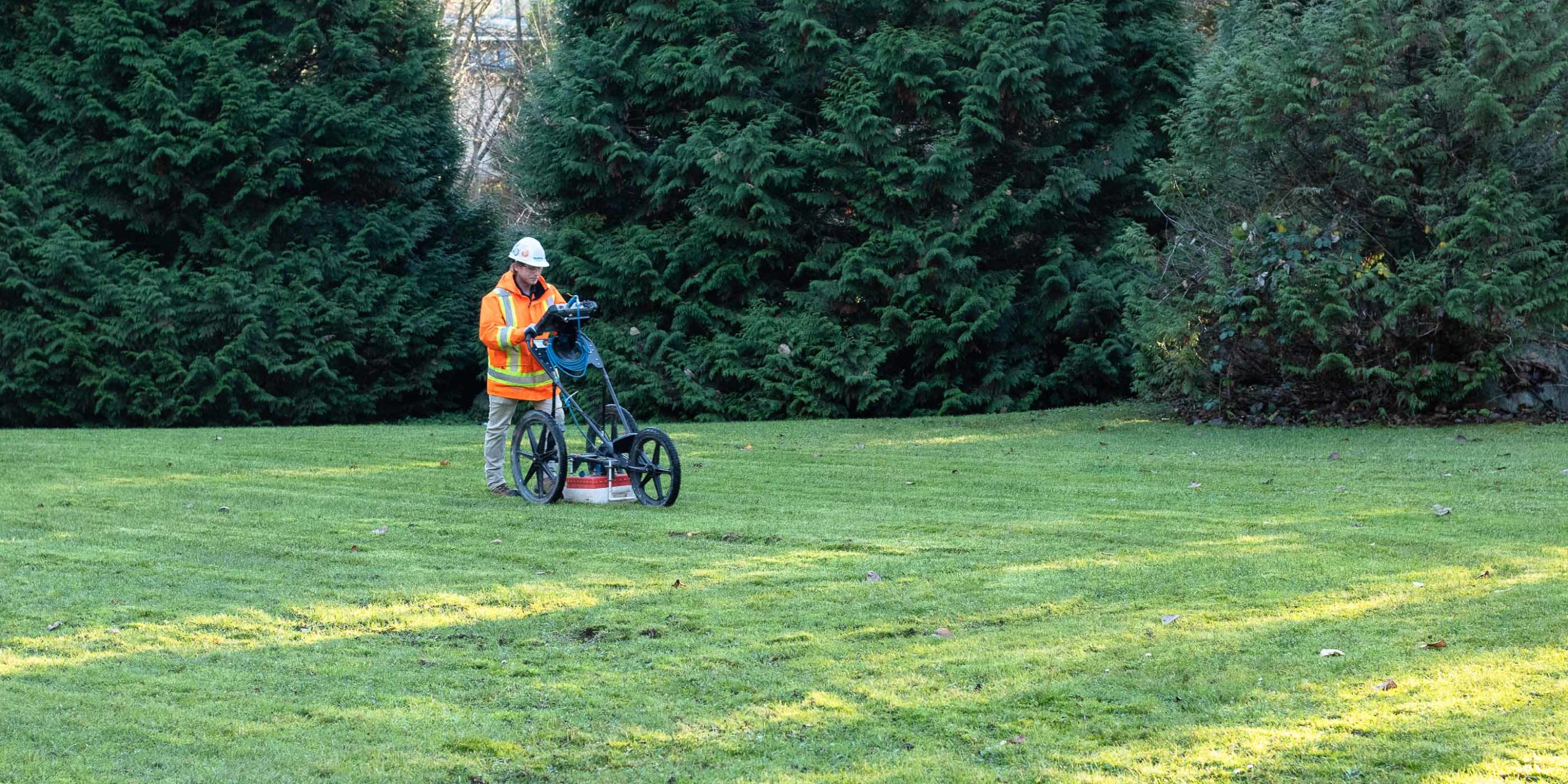
Ground Penetrating Radar (GPR) has a huge range of applications and is the industry standard method for non-destructive testing of metallic and non-metallic targets.
It is the safest and most comprehensive scanning option and as such spans all industries that we work in.
An area that we are currently seeing an increase in demand is geophysical surveys such as archaeology and bedrock mapping. But it doesn’t stop there – here are some of the applications of GPR in geophysics:
Archaeological geophysical surveys
The use of GPR in geophysics (specifically archaeology) is becoming so popular that it recently made the news for its use in the survey of an ancient Roman city at Falerii Novi. The survey was able to reveal previously unrecorded public buildings in the area, giving new insight into the location.
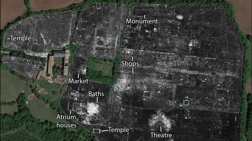
The main benefit of the use of GPR in archaeology is the non-destructive nature of the testing. On dig sites where preserving the objects in the subsurface is imperative, GPR allows you to see the exact location and depth of the targets in a non-invasive manner.
Archaeological sites often cover large areas and being able to carry out a simple sweeping scan also allows those on site to narrow down the potential areas of interest for further investigation.
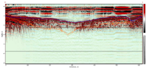
Bedrock mapping and profiling
Bedrock mapping and profiling is essential in providing valuable data for the planning and development of projects such as trenching, construction, drilling, well installation, and geological and hydrogeological studies.
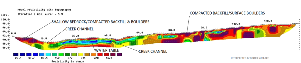
GPR is the ideal method for mapping shallow bedrock as it allows for the fast extraction of data and can be exported in both plan view and profile view datasets. It can also be combined with ERT and Seismic surveys to allow for greater depth and the ability to provide full 3D ground modelling.
Tree root mapping
Understanding and observing root systems is essential to understanding the overall health and stability of any given tree. Trees in urban areas must also be maintained and monitored closely in order to allow them to thrive, while preventing the risk to any surrounding infrastructure.
Before GPR identifying and mapping these root networks was near impossible, while now shallow surveys can provide accurate maps and 3D models of the subsurface structures. In addition internal scanning of mature trees can also identify defects, voids and diseases within tree trunks.
River and lake profiling
Establishing water depth and river profiles provides invaluable information for calculating river flow, water volume and informing lake bottom engineering design. Other applications include scientific investigation, environmental monitoring, and engineering works.
GPR is an often under utilized method when it comes to bathymetry, however, its convenient form factor and ability to operate even if the water is frozen means it is the ideal solution. This same application can also be applied to mapping the ice thickness itself on roads, lakes, rivers and ponds.
Forensic and crime scene geophysics
Similar to its use in archaeological geophysics, forensic and crime scene geophysics is used for locating buried evidence. The speed at which an area can be scanned means that large areas can be surveyed, narrowing down excavation zones, saving investigation time and money.

In these applications, GPR within geophysics is commonly supported by other complimentary methods such as magnetic and conductivity surveys, providing a thorough scan of the area.
For more information on how Ground Penetrating Radar can be applied to your industry, get in touch with one of our expert technicians.