Mapping bedrock depth provides fundamental information for a range of applications across multiple industries
Bedrock mapping is widely beneficial for geological research and testing, and is essential for ground modelling and site characterization. Within construction applications this may include trenching, drilling, blasting and well installation.
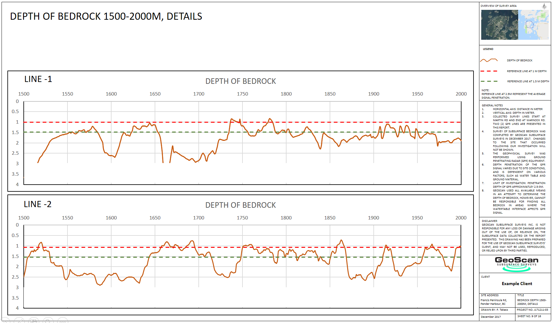
At GeoScan we utilize a multi-method approach to produce 2D profiles or 3D surface models delineating the bedrock horizon. Having this information can help to optimize the design of subsurface infrastructure, and even allow for conflict free installation. Within one of our more commonly service regions, the existence of shallow bedrock makes accurate mapping all the more important.
 Geophysical applications
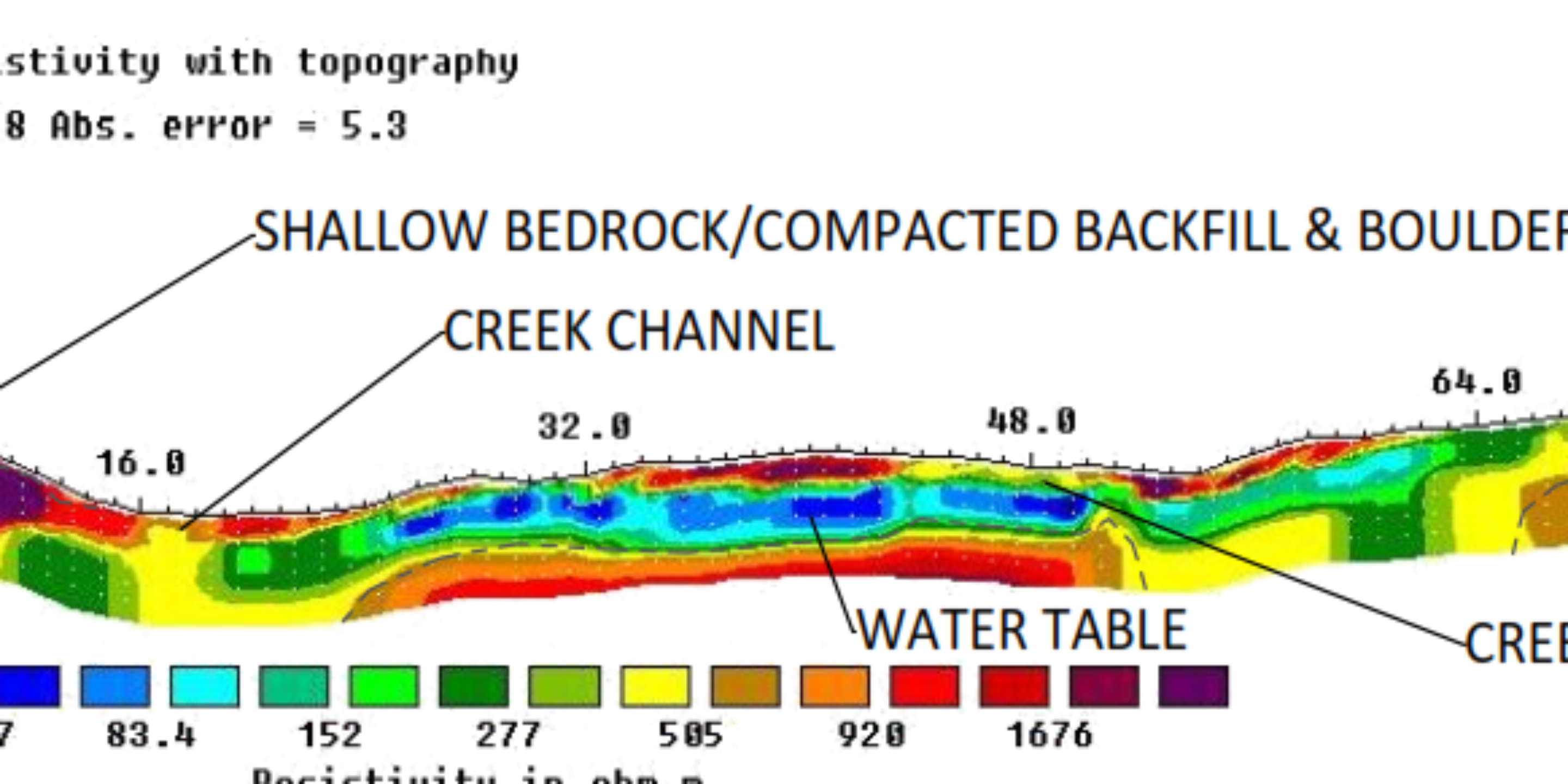
GPR and electrical methods lend themselves to identifying and mapping shallow bedrock and water table, providing fast data collection and both plan view and profile view datasets. ERT and Seismic surveys allow for greater depths and the potential for full 3D ground modelling.
Analyzing multiple 2D profiles or full 3D GPR and resistivity data allows for the identification of bedrock and or low poroperm horizons to provide the building blocks of hydrogeological flow models.
Trenching
Shallow bedrock creates an issue for utility installations as it can dramatically increase the overall price of a project. By having information of the depth of the bedrock along the route of the installation, estimations can be made of where and how much blasting, or excavation of the bedrock is necessary on the proposed line. Furthermore, mapping the bedrock can also provide potential alternative routes for the proposed utility.
Boreholes are very accurate way of mapping the stratigraphy, but they provide very localized (point) information. GeoScan’s bedrock profiling methods have the advantage of creating a literally continuous profile (or a 3 dimensional surface) of the subsurface layers and is able to “connect” borehole results to create the most accurate model of the underground.
Excavating and blasting
Excavating and blasting are required across a number of applications, not just utility installations. We commonly get calls from property developers, especially in hilly locations, where the depth of the underlying bedrock can play a huge role in the development of the property.
With plans to excavate, the presence of bedrock involved the need to blast. This can quickly incur large project costs and cause delays. Being able to accurately map the presence and depth of bedrock is essential in project planning.
Multiple reporting outputs
Implementing our extensive experience in a wide range of projects to optimize survey design and approach, to suit our clients needs and individual project scope.
We provide multiple output formats including full spatial referencing and topography, which are all easy to integrate into existing CAD or GIS. We are flexible with project requirements, budgets and timelines and provide bespoke survey design catered to your needs.