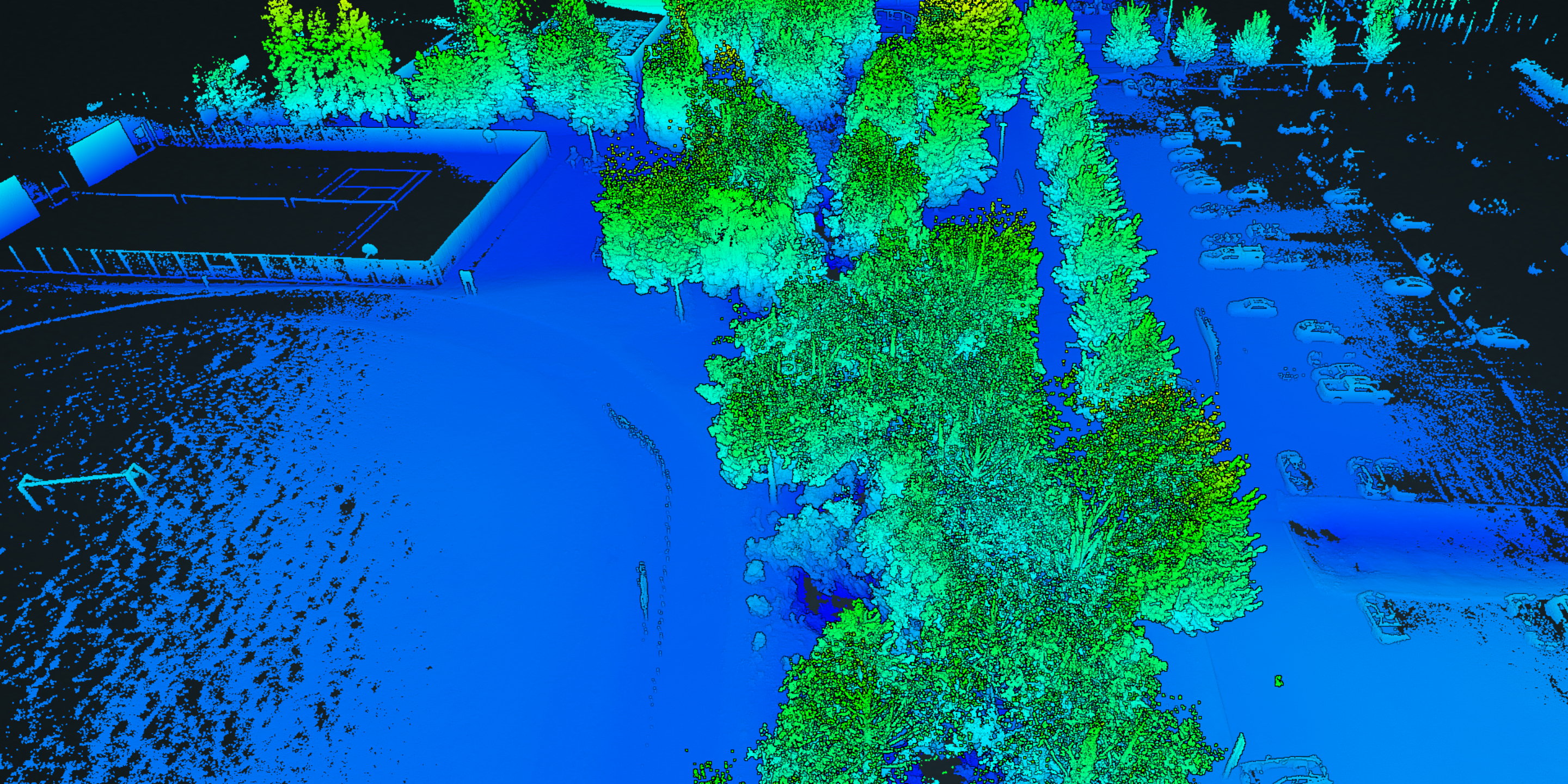
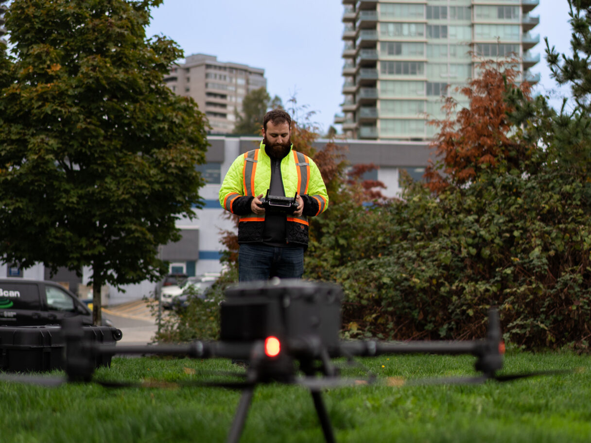
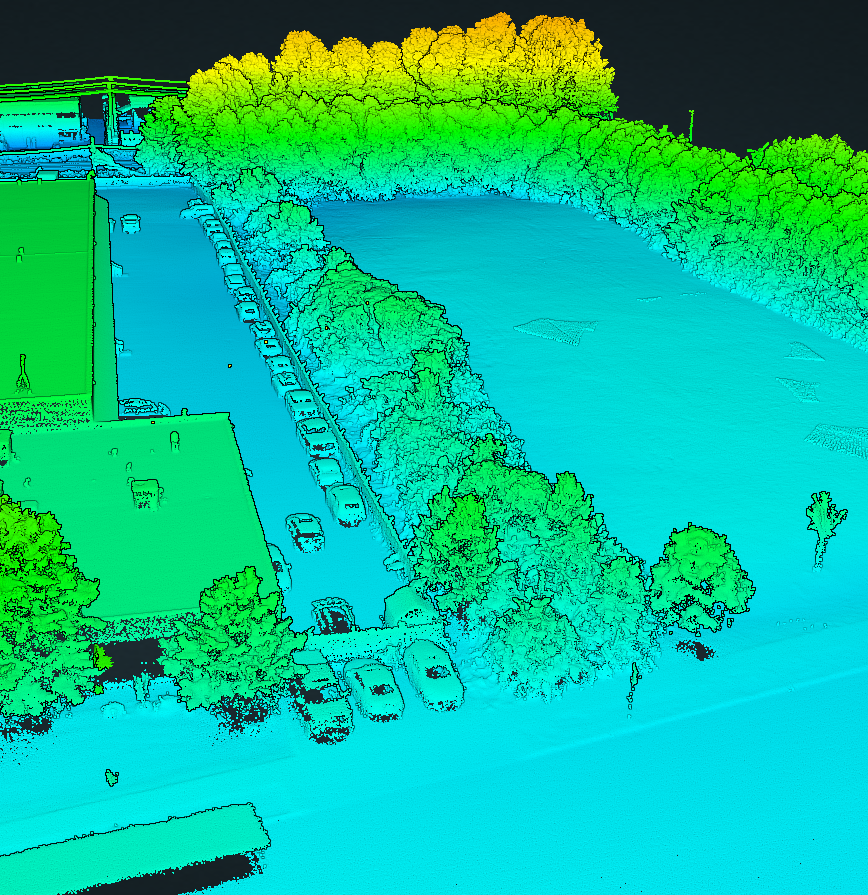
LiDAR (Light Detection and Ranging) surveys revolutionize mapping with laser technology, creating precise 3D models of landscapes and structures. The LiDAR system can be UAV or mobile mounted for fast, precise data collection.
Working with cutting-edge 3D mapping scanners, we capture unprecedented, accurate 3D LiDAR and Photogrammetry data which can then be used for a variety of applications such as topographical mapping, surveying, asset inspection, archaeological investigation, and construction site documentation.
The 3D mapping scanners utilizes laser technology that captures precise point cloud data, allowing our experienced geomatics professionals to generate detailed 3D models and maps in a rapid manner.
LiDAR services have several advantages. They capture tremendous amounts of point data, they cover a lot of ground in a short amount of time, and they allow access to difficult terrain without having to physically walk entire sites.
All of this means we spend less time on site, resulting in reduced risk to workers, and significantly less costs for our clients.
Applications & Benefits
LiDAR services and mobile mapping technology have multifaceted applications. From precision engineering and topographic surveys to deformation monitoring and construction layout, these cutting-edge tools are revolutionizing data collection and analysis across various industries.
Some examples of projects where 3D LiDAR Surveying is optimal include:
- Major transportation projects where significant topographic data is required covering long road corridors
- Rail projects where great detail is required over large areas but there are small windows of access due to train traffic
- Unsafe areas where it is not feasible for persons to access to measure directly (unstable or steep slopes, critical or elevated structures)
- Large excavation or earth moving that require volume calculations
- Vast areas where topographic surveys are required
- Any GNSS denied environments
They are cost-effective for clients, efficient for large-scale jobs along transportation corridors and projects that require monitoring earth movements.
Frequently Asked Questions
1. What is 3D LiDAR Mapping, and how can it benefit my project?
3D LiDAR Mapping is a technology that uses laser sensors to create highly accurate, detailed 3D models of the environment. It benefits various industries by providing precise topographic data, enabling better planning, monitoring, and decision-making for projects in construction, agriculture, forestry, and more.
2. How does GeoScan’s 3D LiDAR Mapping service work?
GeoScan employs state-of-the-art LiDAR sensors mounted on UAVs or ground vehicles. These sensors emit laser pulses that bounce off surfaces and return data to create detailed 3D point cloud models. Our experts then process this data to generate accurate topographical maps and models.
3. What kind of projects can benefit from 3D LiDAR Mapping services?
3D LiDAR Mapping is valuable for a wide range of projects, including land development, infrastructure planning, environmental assessment, flood modeling, and precision agriculture. It can assist in terrain analysis, volumetric calculations, and identifying potential hazards or obstructions.
4. How accurate are the deliverables generated by GeoScan’s LiDAR Mapping services?
GeoScan’s LiDAR Mapping provides vary deliverables depending on the project need, ranging from millimetre to 3.5cm precision. Our technology is capable of capturing fine details, making it suitable for applications that require precise measurements and modelling. Or save cost by mapping at a more course scale to map general features.
3D LiDAR mapping and surveying is safe, versatile, highly accurate and extremely detailed. The geospatial data collected from a LiDAR survey can be seamlessly imported into GIS software or autocad for a fully customisable, digestible deliverable.
With state-of-the-art technology our team at GeoScan can provide solutions all the way from the planning and scanning stages to the data processing and analysis phases.
Clients who can make use of this new service with us include:
- Municipalities
- Cities
- Civil, structural, and geotechnical consultants
- Engineers
- Contractors
- Earth moving companies
- Transportation related firms