January 2021
Whilst driving along Highway 1 through West Vancouver it is hard not to be in awe of the breathtaking views of the landscape and the hilltop homes that lay nestled within the granite mountains of the North Shore but have you ever wondered how is it possible to build these luxury homes in such difficult terrain?
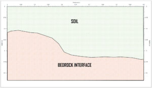
While one of our clients was developing a property on a hillside in West Vancouver, the depth of the underlying bedrock became an important factor in the development. Bedrock is the hard, consolidated rock that usually exists beneath the soil layers of the subsurface but may also be visible above ground. The initial plan was to excavate in places, however, the presence of bedrock would involve blasting and increasing the cost of construction significantly. Without knowing the topography of the bedrock it is difficult to ascertain the best possible build structure for a property. Bedrock can be used to help support the structure if the building foundations are built onto the rockhead. Through the use of non-invasive geophysical techniques it was possible to outline the change from unconsolidated materials to bedrock.
Mapping bedrock can be useful for other applications such as installing a private well or mining another resource. Underground aquifers can be determined through gridded scans provided the natural environment is compatible with the geophysical mapping techniques.
Before the emergence of state-of-the-art non-destructive mapping tools such as Ground Penetrating Radar (GPR) more traditional methods such as drilling or digging were the main ways to find the depth to the bedrock layer beneath the surface. These methods are expensive and intrusive of the land whilst only focusing on test hole areas. Although drilling and excavating are still the most regularly used methods to investigate the subsurface, they have their limitations. Geophysical mapping in comparison is less time consuming and can give coverage of a much larger area than could be done by one drill crew in the same period of time. As a result, the use of geophysical equipment in construction operations has become even more prevalent since the turn of the decade. Cooperation with environmental and engineering companies on the same project allows for a multitude of subsurface data to be assessed. When the geophysical data is compared and combined with geotechnical samples an even more detailed subsurface model can be created.
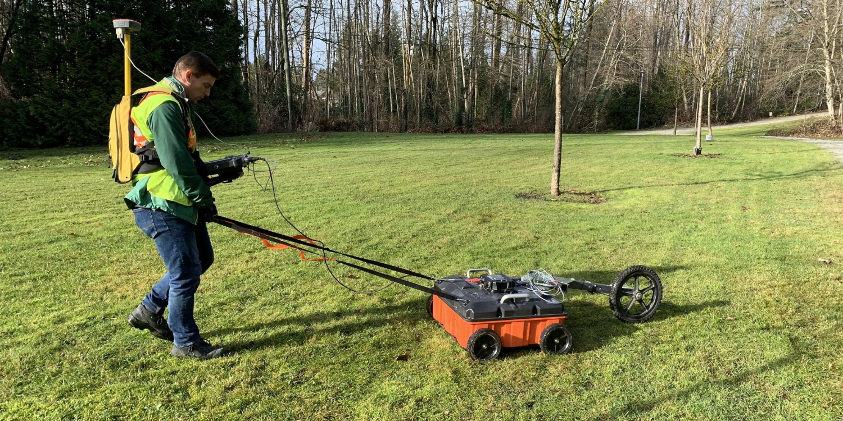
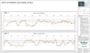
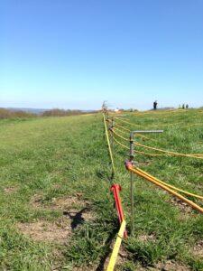
GeoScan were tasked by our client to perform a Ground Penetrating Radar (GPR) scan in order to determine the depth to the bedrock. In doing so our client would then be able to relay this information to their design team who could incorporate it into the construction proposal. Bedrock depth can fluctuate quite significantly especially on hillsides so a subsurface survey of the area can prove very useful.
GeoScan used a low frequency 200 MHz and 400 MHz GPR antenna to achieve greater depth penetration and performed gridded scans along transverses at 1.0m increments to identify bedrock depths across the property. GPR also has capabilities in finding areas of bedrock fracture or faults which are key features related to the proposed structure. Pinpointing these areas of weakness within the bedrock can help to greatly reduce the risk of slope and structure failure during and after the construction phase by mitigating any unnecessary loads on the weaker areas of the rock.
The successful application of GPR is dependant of the physio-chemical conditions of the subsurface. These factors will determine the overall quality of the collected underground data and unsuited soils will result in the loss of the transmitted GPR signal. Radar signals travel well in dry sandy soils whereas saturated clay soils tend to attenuate the electromagnetic energy. Clay content can thus be inversely connected to the penetration levels and resolution of the radar signal.
Electrical resistivity surveys were also performed in combination with the GPR scan. Fusing multiple datasets together allows for increased cross-referencing and analysis of the ground conditions in order to attain the best possible picture of the subsurface. Electrical resistivity works by inducing a current into the ground and reading the potential difference between the evenly spaced electrodes. The variations observed in ground resistivity values can then be linked to the contents of the subsurface.
GPR data was saved so that it could then be further interpretated by our field technicians in the post-processing phase. During this part of the survey filters are applied to the dataset in order to reduce the unwanted noise and to enhance the layers of concern within the data. Global Positioning Systems (GPS) points were collected during the initial survey so that the results of the post-processing could be displayed clearly and precisely on a georeferenced map and kept for future records.
As a result of the survey performed by GeoScan’s field technicians our client was able to pass on the information of the investigation to their engineering team who later amended the design proposal to provide the most efficient, safe and non-intrusive development.
If you’d like to know more please contact our expert team here.


